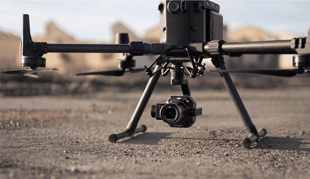
LiDAR technology’s integration with drone aerial inspection has changed the way building sites are run, assessed, and preserved. Real-time, accurate topographical data from drones with LiDAR sensors eliminates the need for laborious manual surveys. Drones create 3D models of the terrain by flying over large construction sites collecting millions of data points. Minimizing physical site visits helps this invention increase project planning accuracy, lower labor expenses, and improve safety. Unmatched power of drone-based LiDAR inspections lets construction workers make faster, more educated judgments.
Increasing Site Planning Accuracy using Drone Aerial Surveying
Centimeter-level accuracy allows a LiDAR drone survey to provide a bird’s-eye picture of the building site. Unlike conventional ground surveys, this technique lets engineers immediately identify elevation changes, subsurface utility conflicts, and possible hazard zones. In the early phases of planning, when precise data is essential for deciding drainage systems, foundation placement, and site grading, this is particularly important. Drone surveys guarantee constant availability of current information, hence enabling quicker revisions of building and design models. Aerial surveying is still redefining planning efficiency for contractors all over as technology develops.
Time-Saving Advantages for Engineers and Project Managers
A key component of construction is time management; drone LiDAR technology helps to simplify schedules significantly. Teams can collect thorough data in only hours instead of days by removing the necessity for boots-on-the-ground surveys. Project managers gain from these time-savings by being able to examine real-time site conditions and make proactive changes. Engineers also value the high-resolution maps produced by LiDAR drones since they enhance design processes and lower the likelihood of redoing. These improvements enable us to meet project deadlines without sacrificing accuracy or safety and directly convert into cost savings.
Improved Safety by Remote Monitoring
Construction sites are naturally dangerous, but drone LiDAR greatly increases worker safety. Drones permit remote monitoring of hazardous or hard-to-reach locations, hence reducing the need for people to traverse unstable ground or run heavy machines in constrained regions. LiDAR mapping also enables early detection of soil instability or structural flaws before they become important. This proactive safety strategy guarantees that before they worsen, dangers are reduced. Companies are already including drone-based safety evaluations in their normal procedures, demonstrating a dedication to employee welfare and compliance with occupational safety requirements.
Improved Land Use and Environmental Analysis
Planning for construction goes beyond only building design; it also includes the surrounding environment. By recording vegetation, water movement, and soil conditions, drone LiDAR enables thorough environmental impact studies. This guarantees that building plans follow land use rules and reduce environmental disturbance. Accurate terrain models let engineers also assess how future development could influence close by ecosystems. Such data-driven analysis not only helps the natural environment but also supports requests for planning permissions. Drone-based environmental surveys help to promote sustainable building practices that governments and stakeholders are more and more demanding.
Tracking Project Progress Exactly
Another field in which drone LiDAR excels is project monitoring. Weekly or monthly flights let you see changes in a construction site’s development, hence enabling precise comparisons with the original site plan. Tracking resource consumption, confirming contractor output, and spotting delays are all aided by this. Models produced by LiDAR allow for simple identification of differences between intended and actual phases of construction. Managers can then move quickly without relying on conventional progress reports. From beginning to end, drone surveillance has therefore become a vital instrument for preserving project openness and responsibility.
Enhanced Teamwork Using 3D Mapping
By producing thorough 3D site models available to all project participants, Drone LiDAR helps to facilitate team cooperation. A single perspective of the building development benefits everyone from investors to contractors to architects. These interactive models promote better cooperation, clear communication, and removal of misconceptions. Cloud-based systems let teams annotate, share, and reference current data, so guaranteeing everyone stays on the same page. Fewer errors follow from this, which improves project results and increases stakeholder happiness.
Cost Effectiveness and ROI in Drone LiDAR Implementation
Though first expenditures in drone LiDAR equipment and software could appear exorbitant, the return on investment is very remarkable. Long-term savings come from faster data collecting, fewer worker hours, less equipment wear, and fewer on-site accidents. Moreover, drone LiDAR improves the bottom line using design error prevention and material waste reduction. Many building companies say that including drones in their operations has hastened payback times. The change to drone-driven construction planning is not only a technical upgrade; it is a wise business move to increase project performance and profitability.
Conclusion:
Drone LiDAR has shown to be more than a tech trend in the fast-changing construction scene of today; it is a vital planning tool. LiDAR-equipped drones are establishing new industry standards from increasing accuracy and safety to strengthening environmental evaluations and cooperation. These developments will help to influence the future of building as businesses want more efficiency, precision, and sustainability. Drone LiDAR is the solution for experts looking for a strong, scalable tool for site design. Visit highexposure.com.au for professional advice and customised services if you want to know more about including aerial solutions in your upcoming project.

